


South Maine--York (West) & Cumberland (West) Counties PUMA, Maine
About
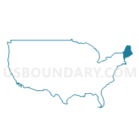
Outline
+%26+Cumberland+(West)+Counties+PUMA%2c+Maine_A280.png)
Summary
| Unique Area Identifier | 193041 |
| Name | South Maine--York (West) & Cumberland (West) Counties PUMA |
| State | Maine |
| Area (square miles) | 1,490.93 |
| Land Area (square miles) | 1,164.97 |
| Water Area (square miles) | 325.96 |
| % of Land Area | 78.14 |
| % of Water Area | 21.86 |
| Latitude of the Internal Point | 43.52912790 |
| Longtitude of the Internal Point | -70.67113830 |
Maps
+%26+Cumberland+(West)+Counties+PUMA in Maine.png)
Graphs
Select a template below for downloading or customizing gragh for South Maine--York (West) & Cumberland (West) Counties PUMA, Maine
+%26+Cumberland+(West)+Counties+PUMA%2c+Maine_T0.png)
+%26+Cumberland+(West)+Counties+PUMA%2c+Maine_T1.png)
+%26+Cumberland+(West)+Counties+PUMA%2c+Maine_T2.png)
+%26+Cumberland+(West)+Counties+PUMA%2c+Maine_T3.png)
+%26+Cumberland+(West)+Counties+PUMA%2c+Maine_T4.png)
+%26+Cumberland+(West)+Counties+PUMA%2c+Maine_T5.png)
+%26+Cumberland+(West)+Counties+PUMA%2c+Maine_T6.png)
+%26+Cumberland+(West)+Counties+PUMA%2c+Maine_T7.png)
+%26+Cumberland+(West)+Counties+PUMA%2c+Maine.png)
Neighbors
Neighoring Public Use Microdata Area (by Name) Neighboring Public Use Microdata Area on the Map
- Cumberland (Outside Portland) & York (East) Counties--Biddeford & Saco Cities PUMA, ME
- Cumberland County (Southeast)--Portland, South Portland & Westbrook Cities PUMA, ME
- Lakes Region--Belknap, Carroll & Merrimack (Northern) Counties PUMA, NH
- Northwest Maine--Oxford, Somerset, Franklin & Piscataquis Counties PUMA, ME
- Sagadahoc & Cumberland (North) Counties--Bath City & Brunswick PUMA, ME
- Seacoast Region--Rockingham County (Southern)--Portsmouth City PUMA, NH
- Strafford Region--Strafford, Rockingham (Northern) & Carroll (Southeastern) Counties PUMA, NH
Top 10 Neighboring County (by Population) Neighboring County on the Map
- Rockingham County, NH (295,223)
- Cumberland County, ME (281,674)
- York County, ME (197,131)
- Strafford County, NH (123,143)
- Oxford County, ME (57,833)
- Carroll County, NH (47,818)
Top 10 Neighboring County Subdivision (by Population) Neighboring County Subdivision on the Map
- Dover city, Strafford County, NH (29,987)
- Rochester city, Strafford County, NH (29,752)
- Biddeford city, York County, ME (21,277)
- Sanford town, York County, ME (20,798)
- Portsmouth city, Rockingham County, NH (20,779)
- Scarborough town, Cumberland County, ME (18,919)
- Saco city, York County, ME (18,482)
- Windham town, Cumberland County, ME (17,001)
- Gorham town, Cumberland County, ME (16,381)
- York town, York County, ME (12,529)
Top 10 Neighboring Place (by Population) Neighboring Place on the Map
- Dover city, NH (29,987)
- Rochester city, NH (29,752)
- Biddeford city, ME (21,277)
- Portsmouth city, NH (20,779)
- Saco city, ME (18,482)
- Somersworth city, NH (11,766)
- Sanford CDP, ME (9,761)
- Old Orchard Beach CDP, ME (8,624)
- Kennebunk CDP, ME (5,214)
- North Windham CDP, ME (4,904)
Top 10 Neighboring Elementary School District (by Population) Neighboring Elementary School District on the Map
- Rye School District, NH (5,298)
- Wakefield School District, NH (5,078)
- Rollinsford School District, NH (2,527)
- Freedom School District, NH (1,489)
- New Castle School District, NH (968)
- Newington School District, NH (753)
Top 10 Neighboring Unified School District (by Population) Neighboring Unified School District on the Map
- Dover School District, NH (29,987)
- Rochester School District, NH (29,752)
- Regional School Unit 23, ME (29,071)
- School Administrative District 06, ME (25,907)
- School Administrative District 17, ME (23,588)
- School Administrative District 57, ME (22,138)
- Regional School Unit 14, ME (21,437)
- Biddeford, ME (21,277)
- Sanford, ME (20,798)
- Portsmouth School District, NH (20,779)
Top 10 Neighboring State Legislative District Lower Chamber (by Population) Neighboring State Legislative District Lower Chamber on the Map
- State House District 1, Strafford County, NH (29,752)
- State House District 3, Strafford County, NH (28,372)
- State House District 16, Rockingham County, NH (21,532)
- State House District 2, Strafford County, NH (14,293)
- State House District 128, ME (10,415)
- State House District 139, ME (10,366)
- State House District 138, ME (10,101)
- State House District 129, ME (10,087)
- State House District 97, ME (10,062)
- State House District 3, Carroll County, NH (10,016)
Top 10 Neighboring State Legislative District Upper Chamber (by Population) Neighboring State Legislative District Upper Chamber on the Map
- State Senate District 21, NH (57,893)
- State Senate District 6, NH (56,650)
- State Senate District 3, NH (56,485)
- State Senate District 24, NH (53,314)
- State Senate District 6, ME (40,612)
- State Senate District 13, ME (40,445)
- State Senate District 2, ME (40,272)
- State Senate District 3, ME (39,567)
- State Senate District 12, ME (39,339)
- State Senate District 5, ME (39,097)
Top 10 Neighboring 111th Congressional District (by Population) Neighboring 111th Congressional District on the Map
- Congressional District 1, ME (668,515)
- Congressional District 2, ME (659,846)
- Congressional District 1, NH (657,984)
Top 10 Neighboring Census Tract (by Population) Neighboring Census Tract on the Map
- Census Tract 173.01, Cumberland County, ME (8,320)
- Census Tract 200, York County, ME (8,034)
- Census Tract 240, York County, ME (7,693)
- Census Tract 842, Strafford County, NH (7,657)
- Census Tract 40.02, Cumberland County, ME (7,551)
- Census Tract 280.02, York County, ME (7,412)
- Census Tract 320, York County, ME (7,246)
- Census Tract 350, York County, ME (7,220)
- Census Tract 360.01, York County, ME (6,891)
- Census Tract 830.01, Strafford County, NH (6,802)
Top 10 Neighboring 5-Digit ZIP Code Tabulation Area (by Population) Neighboring 5-Digit ZIP Code Tabulation Area on the Map
- 03820, NH (30,039)
- 04005, ME (23,146)
- 03801, NH (21,532)
- 04074, ME (18,760)
- 04072, ME (18,482)
- 04062, ME (17,020)
- 04038, ME (16,381)
- 04073, ME (16,189)
- 03878, NH (11,824)
- 04043, ME (10,810)